Journeys · The expedition map
Every trip starts from Ajmer. Follow the line, open a chapter, or skip straight to the archive.
18 in India · 1 beyond · 143 frames
Beyond India
Chapter 01 / 19 · Rajasthan
Ajmer
Home — lakes & birds
26.4786°N 74.6238°E
13 frames
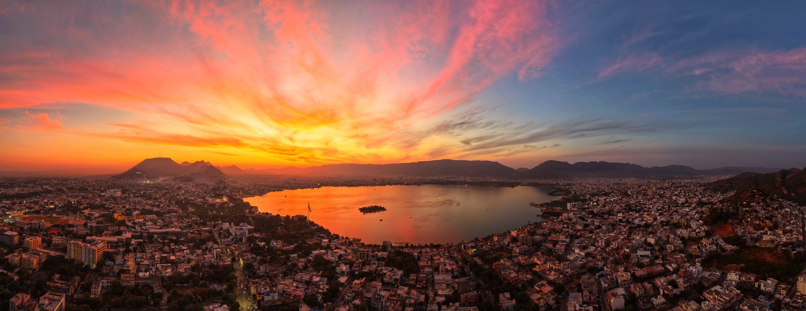
Home. Ana Sagar, where pelicans arrive in winter and painted storks and spoonbills gather on the shore — photographed on the ground and from the air. Clouds rolling below Taragarh at dawn, monsoon storms, Diwali and Dussehra over the lake, and the city lit up at night.
- Season
- Oct – Mar
- Region
- Rajasthan
- Altitude
- 486 m
- Coordinates
- 26.4786°N 74.6238°E
Chapter 02 / 19 · Rajasthan
Pushkar
The holy lake & the fair
26.4897°N 74.5511°E
11 frames
The holy town around its sarovar — the ghats at sunset, the temples by night, the view from Savitri hill — and the Pushkar Fair: camels, herders and the fair ground. Pushkar is also the setting of the song “PUSHKAR”, shot with Akshat as Director of Photography.
- Season
- Oct – Nov
- Region
- Rajasthan
- Altitude
- 539 m
- Coordinates
- 26.4897°N 74.5511°E
Chapter 03 / 19 · Rajasthan
Sambhar Lake
Flamingo season
26.9150°N 75.1000°E
3 frames
India's largest inland salt lake, between Ajmer and Jaipur. In winter its shallows turn pink with flamingos — the setting for Akshat's flamingo series, flown at first light.
- Season
- Nov – Mar
- Region
- Rajasthan
- Altitude
- 316 m
- Coordinates
- 26.9150°N 75.1000°E
Chapter 04 / 19 · Rajasthan
Jaipur
The pink city
26.9200°N 75.8200°E
14 frames
Forts, observatories and temples in pink sandstone — Amber above Maota lake, Hawa Mahal from straight above, the instruments of Jantar Mantar, Jal Mahal, Nahargarh and Galta Ji. Jaipur is also where his work was shown at the state-level exhibition at Birla Auditorium.
- Season
- Oct – Mar
- Region
- Rajasthan
- Altitude
- 558 m
- Coordinates
- 26.9200°N 75.8200°E
Chapter 05 / 19 · Rajasthan
Abhaneri
Chand Baori
27.0075°N 76.6068°E
1 frames
Chand Baori, one of India's deepest stepwells — thousands of steps folding down to the water, photographed from directly above.
- Season
- Oct – Mar
- Region
- Rajasthan
- Altitude
- 493 m
- Coordinates
- 27.0075°N 76.6068°E
Chapter 06 / 19 · Rajasthan
Alwar
Palaces under the hills
27.5686°N 76.5935°E
3 frames
Moosi Maharani ki Chhatri beneath the Aravallis, and the lake palace at Siliserh in the monsoon green.
- Season
- Jul – Mar
- Region
- Rajasthan
- Altitude
- 395 m
- Coordinates
- 27.5686°N 76.5935°E
Chapter 07 / 19 · Rajasthan
Shekhawati
Fog & stepwells
28.3800°N 75.8800°E
4 frames
Winter mornings in Jhunjhunu, when fog fills the fields to the treetops — and the stepwells of the region, seen from above.
- Season
- Dec – Feb
- Region
- Rajasthan
- Altitude
- 245 m
- Coordinates
- 28.3800°N 75.8800°E
Chapter 08 / 19 · Rajasthan
Bikaner
Desert city
28.0200°N 73.3100°E
6 frames
On the edge of the Thar — Junagarh Fort and its painted halls, Lalgarh Palace, the red sandstone havelis of the old city, and sundown in the dunes at Raisar.
- Season
- Oct – Mar
- Region
- Rajasthan
- Altitude
- 357 m
- Coordinates
- 28.0200°N 73.3100°E
Chapter 09 / 19 · Rajasthan
Jodhpur
The blue city
26.2900°N 73.0200°E
2 frames
The Ghanta Ghar with Mehrangarh rising behind it over a city painted blue, and the temples and cenotaphs of Mandore.
- Season
- Oct – Mar
- Region
- Rajasthan
- Altitude
- 301 m
- Coordinates
- 26.2900°N 73.0200°E
Chapter 10 / 19 · Rajasthan
Ranakpur
The marble temple
25.1158°N 73.4707°E
1 frames
The Ranakpur Jain temple in the Aravalli forest — its domes and spires, seen from the air.
- Season
- Oct – Mar
- Region
- Rajasthan
- Altitude
- 525 m
- Coordinates
- 25.1158°N 73.4707°E
Chapter 11 / 19 · Rajasthan
Udaipur & Nathdwara
Mewar
24.5734°N 73.6824°E
8 frames
Lake Pichola and the City Palace at sunrise and blue hour, the Monsoon Palace at Sajjangarh against the sunset — and at Nathdwara, the Statue of Belief.
- Season
- Sep – Mar
- Region
- Rajasthan
- Altitude
- 633 m
- Coordinates
- 24.5734°N 73.6824°E
Chapter 12 / 19 · Rajasthan
Chittorgarh
The great fort
24.8877°N 74.6460°E
2 frames
The Vijay Stambh and the ramparts of Chittorgarh, stretched along their plateau in the monsoon.
- Season
- Jul – Mar
- Region
- Rajasthan
- Altitude
- 756 m
- Coordinates
- 24.8877°N 74.6460°E
Chapter 13 / 19 · Rajasthan
Bundi, Menal & Kota
Monsoon waterfalls
25.3000°N 75.4100°E
5 frames
When the rains come, the plateau of Hadoti pours over its edges — Bhimlat and Menal in full flood. Taragarh above Bundi, and a mugger basking on the Chambal at Kota.
- Season
- Jul – Sep
- Region
- Rajasthan
- Altitude
- 316 m
- Coordinates
- 25.3000°N 75.4100°E
Chapter 14 / 19 · Rajasthan
Banswara
The city of a hundred islands
23.5735°N 74.5405°E
3 frames
The backwaters of the Mahi — scattered green islands, the dam with its gates open, and monsoon falls in the hills around.
- Season
- Aug – Oct
- Region
- Rajasthan
- Altitude
- 490 m
- Coordinates
- 23.5735°N 74.5405°E
Chapter 15 / 19 · Gujarat
Ahmedabad & the Statue of Unity
Gujarat
23.0300°N 72.5800°E
1 frames
A documentary shoot for the Government of Gujarat on 1–2 August 2025, around TTF Ahmedabad — the Sabarmati Riverfront, Atal Bridge, Adalaj stepwell, Kankaria Lake and the old heritage city. And at Kevadia, the Statue of Unity.
- Season
- Nov – Feb
- Region
- Gujarat
- Altitude
- 16 m
- Coordinates
- 23.0300°N 72.5800°E
Chapter 16 / 19 · Kerala
Kerala
The backwaters
9.4704°N 76.3648°E
1 frames
The backwaters of Alappuzha at dusk, from the air.
- Season
- Sep – Mar
- Region
- Kerala
- Altitude
- 69 m
- Coordinates
- 9.4704°N 76.3648°E
Chapter 17 / 19 · Uttar Pradesh
Varanasi
The river city
25.3100°N 83.0100°E
6 frames
The ghats of the Ganga — from the river by day, and from the air on Dev Deepawali, when the whole crescent of the river is lit with lamps.
- Season
- Oct – Mar
- Region
- Uttar Pradesh
- Altitude
- 29 m
- Coordinates
- 25.3100°N 83.0100°E
Chapter 18 / 19 · Assam · Meghalaya
Assam & Meghalaya
The north-east
25.5000°N 92.0000°E
8 frames
The waterfalls of Meghalaya — Nohkalikai, Krang Suri and the falls of Sohra and the Jaintia Hills — the monoliths of Nartiang, Shillong from the air, and sunset on the Brahmaputra at Guwahati.
- Season
- Oct – May
- Region
- Assam · Meghalaya
- Altitude
- 1,265 m
- Coordinates
- 25.5000°N 92.0000°E
Chapter 19 / 19 · Abroad
Australia
Sydney · the coast · the reef
33.8568°S 151.2153°E
9 frames
June 2025 — Sydney Harbour from the air and the water, the Sea Cliff Bridge on the Illawarra coast, Brisbane's Story Bridge by night, a humpback breaching off the Gold Coast and a tall ship off Fitzroy Island near Cairns.
- Season
- June 2025
- Region
- Abroad
- Altitude
- 174 m
- Coordinates
- 33.8568°S 151.2153°E
AThe archive
● Next frame
Tourism collaborations, talks and workshops, or a conversation about a photograph — write to me.
Ana Sagar at sunset, from the air · 14mm